Land surveying
Build a dedicated solution page and link it back to SP35, SP30, SP20 and the buying guide.
Product detail template
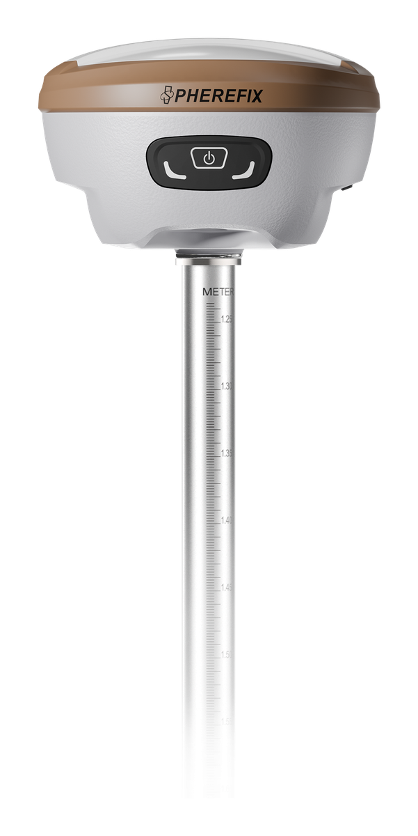
Compact multi-band GNSS RTK receiver for AR real-scene stakeout, camera-assisted laser surveying, IMU tilt measurement and professional field positioning workflows.
High-conversion structure
Reference strong competitor product pages for structure only: overview, highlights, specs, download, related products and free quote. Keep Spherefix identity and official product facts.
Applications
Build a dedicated solution page and link it back to SP35, SP30, SP20 and the buying guide.
Build a dedicated solution page and link it back to SP35, SP30, SP20 and the buying guide.
Build a dedicated solution page and link it back to SP35, SP30, SP20 and the buying guide.
Build a dedicated solution page and link it back to SP35, SP30, SP20 and the buying guide.
Verified specs only
Use official Spherefix PDFs and catalogs as the source of truth. Leave fields blank when not verified.
Download module
Offer brochures, specs, manuals and software guides after a lead-friendly inquiry path.
Replace with the official SP35 PDF from the shared Spherefix specification folder.
Request download accessFAQ and AI search blocks
Yes. Duplicate it into country, language or application variants while keeping official Spherefix claims and verified specs.
Yes. Add values only from official Spherefix PDFs, catalogs or product pages.
Name, email, WhatsApp, country, company, interested product, quantity, application and message.